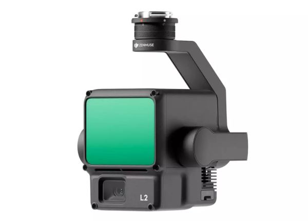
DJI Zenmuse L2


* Prices incl. VAT
Free shipping
In Stock - Shipping in 1-4 Days
For international delivery time
➥ go to Shipping Conditions page.
- Order number: 102992
- 3 years MusoTec Guarantee
- - 3% Discount on Pre-Payment
Discount will be deducted in Checkout!

DJI Zenmuse L2
Zenmuse L2 is characterised by an advanced LiDAR module, a high-precision IMU system developed by DJI itself and a 4/3 CMOS RGB mapping camera that allows DJI flight platforms to capture geodata even more precisely, efficiently and reliably. In combination with DJI Terra, L2 also becomes an instant solution for 3D data collection and high-precision post-processing.
- Highly accurate - Vertical accuracy: 4 cm; Horizontal accuracy: 5 cm[1]
- Exceptional efficiency - 2.5 km2 in a single flight[2]
- Superior penetration - Smaller laser points, denser point clouds
- Detection range[3] 250 m at 10 % remission, 100 klx 450 m at 50 % remission, 0 klx
- 5 returns 5 returns
- Ready for immediate use[4]
- Live view of the point cloud
- One-click processing in DJI Terra
Integrated LiDAR solution
Thanks to its powerful hardware, L2 enables precise scans of complex subjects at greater range and faster point cloud acquisition. Users can view, replay and edit point cloud models on the spot and on the fly. DJI Terra's task quality reports provide a simple, centralised solution and improve overall efficiency. This enables users to generate highly accurate point clouds with a single post-processing step.
Precision at a high level
The combination of GNSS and a high-precision IMU developed by DJI itself achieves a vertical precision of 4 cm and a horizontal precision of 5 cm. [1]
Exceptional efficiency
It is ready to use immediately after switching on and can capture both geodata and RGB data over a 2.5km2 area in a single flight[2].
Intuitive operation
Combined with Matrice 350 RTK and DJI Terra, the L2 provides an instant solution that is easy to use and significantly reduces previous limitations.
Frame-based LiDAR
Increase detection range by 30 %[5]
Only 10 % reflectivity at 100 klx[3] up to 250 metres and 50 % reflectivity and 100 klx up to 450 metres[3]. In addition, the typical operating height now extends up to 120 metres, which significantly increases operational safety and efficiency.
Smaller laser points, denser point clouds
With a point size reduced by 80 % compared to the L1, now only 4 x 12 cm at 100 metres, the L2 not only captures smaller objects in much greater detail, it also penetrates dense vegetation even better, resulting in more precise digital elevation models (DEM).
Supports 5 returns
In densely vegetated areas, the L2 can capture more ground points under the foliage.
Effective point cloud rate: 240,000 pts/s
In both single and multiple return modes, the L2 can achieve a point cloud emission rate of up to 240,000 points per second, allowing more point cloud data to be captured in a given time frame.
Two scanning modes
L2 supports two scanning modes, giving users more flexibility based on their requirements. Repetitive scanning allows the L2's LiDAR to achieve more uniform and accurate point clouds while meeting the requirements for high-precision mapping. In non-repetitive scanning mode, it achieves deeper penetration and provides more structural information - ideal for power line inspections, forestry surveys and similar scenarios.
Frame-based design
The frame-based design enables an effective point cloud data rate of up to 100 %. Together with a three-axis gimbal, this offers many more possibilities in various surveying scenarios.
High-precision IMU system
Improved accuracy
DJI's proprietary high-precision IMU system, combined with the drone's RTK positioning system for data fusion during post-processing, enables L2 to access highly accurate and absolute position, velocity and altitude information. In addition, L2's operational reliability and precision are increased thanks to the IMU system's improved adaptability to environmental conditions.
Yaw accuracy[6] Real-time: 0.2°, post-processing: 0.05°
Pitch/roll accuracy[6] Real-time 0.05°, post-processing 0.025°
No IMU warm-up
The performance of the IMU system has been significantly improved and it is now ready for use as soon as it is switched on. The associated drone is also immediately ready for take-off as soon as the RTK is in "FIX" status - making every field operation even easier.
RGB mapping camera
4/3 CMOS, mechanical shutter The pixel size has been increased to 3.3 μm and the effective pixels now reach 20 MP, which contributes to a significant improvement in the overall imaging and colour representation of point clouds. The minimum photo interval has been reduced to 0.7 seconds. The mapping camera also offers up to 200,000 releases, which further reduces operating costs. When point cloud capture is not required, the RGB camera can continue to take photos and videos or generate images to map visible areas.
Improved user experience
Different flight route types
Supports waypoint, area and linear route types for performing surveying tasks in a variety of environments.
Live view of the point cloud
During operation, DJI Pilot 2 offers three display modes: RGB, point cloud and point cloud/RGB in parallel view, displaying the respective results in an intuitive way. By activating RNG (laser range finder), information on the distance between the LiDAR module and the object in the centre of the FOV is obtained, which increases flight safety. In addition, four colour modes are supported for real-time point clouds: Reflectivity, Altitude, Distance and RGB.
Playback and merging of point cloud models
After operation, the 3D point cloud model [7] can be displayed directly in the album. 3D point cloud models from multiple flights can also be merged to make on-site decisions regarding operational quality.
Automatically generated task quality report
After capturing point cloud data, the DJI Pilot 2 app automatically generates a job quality report [8] so users can review operational results in real time and on the spot, making field operations more spontaneous and worry-free.
PPK solutions
In complex operational environments, users can set up RTK base stations before operation to avoid loss of RTK data due to interference, video transmission interruptions or other problems. After operation, the original files can be imported into DJI Terra to use the PPK (Post Processed Kinematics) process to reconstruct high-precision models.
One-click editing in DJI Terra
Efficient and reliable one-step post-processing after importing point cloud data into DJI Terra: Generate a 3D point cloud model in standard format with one click - after point cloud trajectory calculation and accuracy optimisation. A DEM can also be created via "Ground point type" to classify the survey point. The quality of the point cloud can be analysed using the "Accuracy check and verification" function. Application scenarios In combination with DJI Enterprise flight platforms and DJI Terra, Zenmuse L2 can be used for land surveying and mapping, electricity management, forestry, infrastructure management and various other scenarios. Land surveying and mapping Electricity management Forestry Infrastructure management
Scope of delivery:
1x Zenmuse L2
1x hard case
1x 24 months DJI Care Enterprise Basic (Auto-Activated)